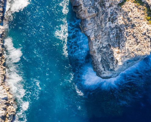
Sentinel Thematic Areas – Marine Monitoring
The Copernicus Sentinel missions support marine monitoring by providing provide timely, continuous and independent data on the behaviour, use, and health of the oceans and the associated coastal zones.
The Sentinel missions provide data support to federal, national and local studies and activities, and are pivotal in helping address a variety of policy areas.
- Sentinel-1 provides an all-weather, day-and-night radar imaging capability for Copernicus ocean services involved in the management and monitoring of the European marine environment, the Arctic environment and associated sea-ice measurement, and the surveillance of the open ocean to establish directional observations of surface wave and wind observations, and for threats such as oil spills. More on Sentinel-1’s maritime monitoring applications can be found in the User Guide.
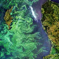
- Sentinel-3‘s main mission is to provide a multi-instrument capability to support the accurate parameterisation of such topics as Ocean Colour (OC), Sea Surface Height (SSH) and Sea Surface Temperature (SST). Along with SST, OC can be used to support the accurate estimation of oceanic carbon fluxes. The Altimetry Instrument onboard Sentinel-3 supports Marine applications such as Oceanography. More on Sentinel-3’s maritime monitoring applications can be found in the User Guide.
Specific Areas – Marine Monitoring
Marine Safety – Marine Safety is the well-being and quality of the ocean. Satellites can help to ensure this continued safety and examine threats to it by observing oil spills and other potential hazards.
Marine Resources – The marine environment is an abundant source of resources, and provides food, natural resources in the form of oil, gas and minerals, and the power of the ocean can be harnessed for generating energy. Satellites can help to locate and study these resources.
Marine & Coastal Environment – Studying the ocean’s environment and the state of the coasts provides greater understanding of how these can be affected by natural processes, changing climate and human intervention.
Climate & Seasonal Forecasting – Satellites are a vital tool for monitoring the climate and how it can affect weather seasons, leading to phenomena such as the “El Nino”. This is useful for forecasting potential weather systems.
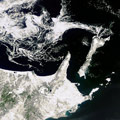
Sea Ice – Sea ice is formed from ocean water that freezes, whether along coasts or to the sea floor (fast ice) or floating on the surface (drift ice) or packed together (pack ice). The most important areas of pack ice are the polar ice packs. Because of vast amounts of water added to or removed from the oceans and atmosphere, the behavior of polar ice packs have a significant impact of the global changes in climate.
Source: https://sentinels.copernicus.eu/web/sentinel/thematic-areas/marine-monitoring


 https://sentinels.copernicus.eu/
 https://sentinels.copernicus.eu/
Leave a Reply
Want to join the discussion?Feel free to contribute!