The Copernicus Sentinel missions support atmospheric monitoring by providing timely, continuous and independent data on the atmosphere, and provide data to support federal, national and local studies and activities, and help in addressing a variety of policy areas.
Sentinel-3
OLCI supports investigations into atmospheric composition (mainly aerosols and water vapour) which is a fundamental parameter for climate studies, and also contributes to the measurements of the downwelling solar radiation (long-wave and short-wave) at the Earth’s surface and Top Of Atmosphere, which are critical to the estimation of the global Surface Radiation Budget (SRB).
The MWR instrument measures the atmospheric water content in liquid and vapour phases. This information will be used to enable the Sentinel-3 mission to meet the required altimetry accuracy requirements for the measurements acquired by the SRAL instrument on the same platform.
The multi-angle, multi-wavelength viewing geometry of the SLSTR instrument supports the characterisation and investigation of cloud properties through the development of operational cloud products.
Sentinel-5P
The TROPOMI instrument aboard Sentinel-5P is a dedicated atmospheric monitoring mission, and measures air quality, ozone and ultraviolet radiation, and provides climate monitoring and forecasting.
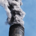
Greenhouse Gases – Greenhouse gases help to keep our planet warm, but with too much the planet’s temperature would increase, and by contrast the temperature would plummet without these gases. Satellites can help to measure the accumulations of gas in the atmosphere and determine future trends.
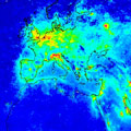
Reactive Gases – In terms of atmospheric monitoring, highly reactive gases of ones which when exposed to sufficient quantities of heat and light chemically react and absorb or deplete the surrounding levels of ozone in the atmosphere. It is thus important to observe the levels of these potential threatening gases.
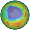
Ozone & Solar UV Radiation – The measurement of change in the ozone layer is today operationally possible at a high temporal and spatial resolution in near real-time allowing ongoing updates of the effects of pollution.
Aerosols – Satellites can help to monitor the potential harmful aerosol levels in the atmosphere and distinguish between natural and human-made aerosols. This is an important tool in efforts to prevent further atmospheric pollution.
Source: https://sentinels.copernicus.eu/web/sentinel/thematic-areas/atmospheric-monitoring
The Copernicus Sentinel missions provide data support to federal, national and local studies and activities, and are pivotal in helping address a variety of policy areas.
In terms of EO services requirements, the needs of the downstream security services that utilise Sentinel data are broadly similar to those of the emergency service, but differ in that information relating to security issues beyond European borders are acquired when judged necessary. In addition, the data is used to support monitoring of illegal activities such as unregulated logging and mining.
Sentinel-1 supports land-based food security and crop monitoring, with the objective of providing EO related services to global food security and associated environmental processes. It also supports the needs of the maritime community in sea-ice and iceberg monitoring, vessel tracking and monitoring of fisheries.
Sentinel-2 contributes to existing food security services and monitoring programmes, and enables the continuation of monitoring (under cloud-free conditions) of vegetation in Africa by analysing long-term Earth observation time-series data, and supplying detailed information on major food crops, such as planting dates and the extent of cultivation.
Sentinel-3 supports food security programmes involved in crop management and yield estimation, and maritime security programmes supporting monitoring of ice shipping lanes and coastal areas.
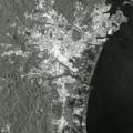
Border Surveillance – The control and surveillance of borders is essential to monitor and reduce cross border crime. Satellite data can also be used to protect critical infrastructure such as pipelines and installations.
Maritime Surveillance – Maritime surveillance includes monitoring of sea borders, maritime safety, illegal immigration, and illegal trafficking.
Support to European External Action Service – The European External Action Services is a foreign diplomatic service of the UN. Satellite data supports the EEAS by providing intelligence to its security initiatives and programmes that are crucial for securing Europe’s future.
Source: https://sentinels.copernicus.eu/web/sentinel/thematic-areas/security

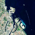
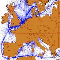
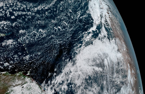
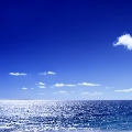
The Copernicus Sentinel missions support marine monitoring by providing provide timely, continuous and independent data on the behaviour, use, and health of the oceans and the associated coastal zones.
The Sentinel missions provide data support to federal, national and local studies and activities, and are pivotal in helping address a variety of policy areas.
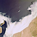
Marine Safety – Marine Safety is the well-being and quality of the ocean. Satellites can help to ensure this continued safety and examine threats to it by observing oil spills and other potential hazards.
Marine Resources – The marine environment is an abundant source of resources, and provides food, natural resources in the form of oil, gas and minerals, and the power of the ocean can be harnessed for generating energy. Satellites can help to locate and study these resources.
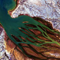
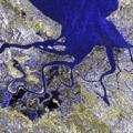
Marine & Coastal Environment – Studying the ocean’s environment and the state of the coasts provides greater understanding of how these can be affected by natural processes, changing climate and human intervention.
Climate & Seasonal Forecasting – Satellites are a vital tool for monitoring the climate and how it can affect weather seasons, leading to phenomena such as the “El Nino”. This is useful for forecasting potential weather systems.
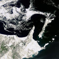
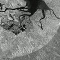
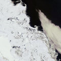
Sea Ice – Sea ice is formed from ocean water that freezes, whether along coasts or to the sea floor (fast ice) or floating on the surface (drift ice) or packed together (pack ice). The most important areas of pack ice are the polar ice packs. Because of vast amounts of water added to or removed from the oceans and atmosphere, the behavior of polar ice packs have a significant impact of the global changes in climate.
Source: https://sentinels.copernicus.eu/web/sentinel/thematic-areas/marine-monitoring
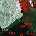
The Coprenicus Sentinel missions support emergency management by providing timely, continuous and independent data on a near-real-time basis. The Sentinel missions provide data support to federal, national and local studies and activities, and are pivotal in helping address a variety of policy areas.
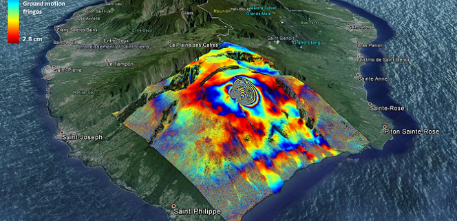
The SAR instrument of Sentinel-1 provides the ability to produce high resolution, co-seismic maps of earthquake deformations. In addition, Sentinel-1 provides support to monitoring earthquake prone areas, and the discovery, mapping and monitoring of fault lines. More on Sentinel-1’s emergency management applications can be found in the User Guide.
Sentinel-2 supports rapid mapping, including those services that are components of the Copernicus Emergency Management Service (EMS). The EMS reinforces the European capabilities and services involved in crisis response. Two families of rapid mapping services are provided: “Reference Maps” derived from data collected prior to the event, and “Assessment maps” that are generated during the event.
The Altimetry mission of Sentinel-3 provides support to Flood monitoring.
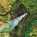
Floods – The increasing number of intense meteorological events means that flood events are more frequent. Their monitoring is essential to rescue and civil defence authorities, whilst mapping of their extent is widely by insurance companies.
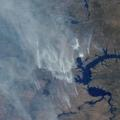
Forest Fires – The identification of fire hot spots and the spread of fire events from satellite is used not only in the natural environment but also for fires linked to industrial disasters.
Landslides – The mapping of the extent of damage caused by large landslides is crucial to the recovery services. A large amount of work is however aimed particularly at the study of prediction and prevention of such events.
Earthquakes & Volcanic Eruptions – The tragic consequences of both earthquake and volcanic activity are obvious, their monitoring and timely mapping is essential to aid rescue efforts. While improved prediction is aimed at reducing the impact of any such an event.
Humanitarian Crises – In recent years Earth Observation satellites have become a new asset at the disposal of emergency response teams. Satellites can perform rapid damage-mapping to help guide rescue efforts.
Oil Spills – The possibility of using satellite data over ocean areas to monitor the spread of oil spills is essential in directing the interventions of the environmental authorities, thereby ensuring timely cleansing and reducing their impact.
Source: https://sentinels.copernicus.eu/web/sentinel/thematic-areas/emergency-management
The Copernicus Sentinel missions support climate change studies by providing data that can be used to supplement heritage time-series acquisitions. This information can provide additional weight to data acquired by European and international Earth observation programmes, and supports the response and management of related policy issues within Europe at federal, national and local levels.
Sentinel-1 provides the ability to acquire data on forest fire scar mapping, which can be used to map the history and lifecycle of forests, with particular regard to the carbon content. Fire scar mapping also plays an important role in mapping of forest fire scars, can be an important part of mapping the carbon history of a forest and provides support in the estimation of carbon emissions.
Sentinel-2 provides land monitoring support to climate change via monitoring of aspects such as soil use and land use change. This information can be used to support European environmental policy, and help to improve the efficiency and effectiveness of the international humanitarian response to climate related emergencies. More information on the MSI instrument’s support to this application can be found in the User Guide.
Sentinel-3 provides Sea Surface Temperature data for use by the climate scientific research community, and supports ocean forecasting and weather prediction.
Land monitoring – The impact of climate change on the Earth’s surface can be studied from orbit, offering a broader perspective than in-situ observations.
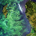
Marine Environmental Monitoring – The study of the marine environment is primarily utilised by the fishing industry to monitor algal blooms and phytoplankton distribution, both key elements of the oceanic food chain.
Atmospheric Monitoring – Space-based sensors help detect otherwise invisible changes, peering either sideways or down through the atmosphere to build up three-dimensional views of its chemical composition, sensitive to a few parts per billion.
Source: https://sentinels.copernicus.eu/web/sentinel/thematic-areas/climate-change
The role of the Sentinel missions is to provide timely, continuous and independent data on the use of land as a resource, and to support the management and monitoring of its ability to withstand increasing socio-economic pressures. Land monitoring covers a wide range of resources and associated policies:
The Sentinel missions provide data support to federal, national and local studies and activities, and are pivotal in helping address a variety of policy areas.
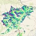
Land Cover, Use and Change Detection Mapping – Land cover is the material that covers the Earth’s surface, such as vegetation and water. Satellites can be used to monitor how this land cover is being used and detect changes to the land over time.
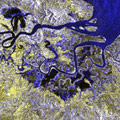
Bio-geophysical Variable Mapping – Bio-geophysical parameters are biological, geological and physical terms that play a role in the Earth’s land, such as plant species, soil types, and heat and light. Variable mapping studies these parameters and how they change over time.
Risk Mapping – Identifying risks on land and in water can be a vital tool for prevention and for providing solutions. Satellites can provide invaluable views from a higher perspective, and help to analyse risks.
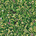
Precision Farming – Precision farming utilising satellite data is a method of managing farms with a high degree of accuracy. Satellite observations can precisely track variations in fields and provide statistics which can be used to determine what tools, practices and decisions may be best for a farm.
Forest Monitoring – The world’s forests play an important role in the climate, and so monitoring them is a useful indication of how the climate may be changing. It is also useful for tracking both deforestation and forestation.

Desertification – Desertification is the process by which land becomes increasingly dry, until the moisture in the land is depleted. This leads to the eventual absence of vegetation and the animals that thrive in such conditions.
Snow & Ice – One tenth of Earth’s surface is permanently covered in ice, but snow and ice is present across the world at varying amounts during the seasons. This process of ice forming and melting is an important indication of climate change, and satellites play a vital role in tracking this.
Source: https://sentinels.copernicus.eu/web/sentinel/thematic-areas/land-monitoring
Instruments carried aboard the Copernicus Sentinel satellites focus on different aspects of the Earth System.
List of thematic areas:
Source: https://sentinels.copernicus.eu/web/sentinel/thematic-areas
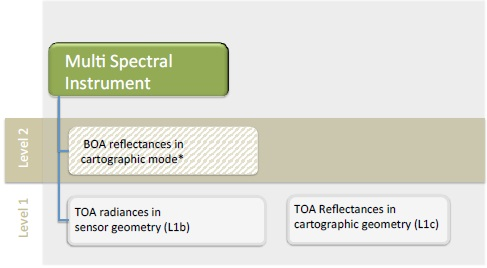
Sentinel-2 products available for users (either generated by the ground segment or by the Sentinel-2 Toolbox) are listed in the product types table.
| Name | High-Level Description | Production & Distribution | Data Volume |
| Level-1C | Top-Of-Atmosphere reflectances in cartographic geometry | Systematic generation and online distribution | ⁓600MB (each 100km x 100km2) |
| Level-2A | Bottom-Of-Atmosphere reflectances in cartographic geometry | Systematic and on-user side (using Sentinel-2 Toolbox) | ⁓800MB (each 100km x 100km2) |
Products are a compilation of elementary granules of fixed size, along with a single orbit. A granule is the minimum indivisible partition of a product (containing all possible spectral bands).
For Level-1C and Level-2A, the granules, also called tiles, are 100×100 km2 ortho-images in UTM/WGS84 projection. Download the Sentinel-2 tiling grid kml.
The UTM (Universal Transverse Mercator) system divides the Earth’s surface into 60 zones. Each UTM zone has a vertical width of 6° of longitude and horizontal width of 8° of latitude.
Source: https://sentinels.copernicus.eu/web/sentinel/missions/sentinel-2/data-products
 https://sentinels.copernicus.eu/
 https://sentinels.copernicus.eu/
 https://sentinels.copernicus.eu/
 https://sentinels.copernicus.eu/