 https://sentinels.copernicus.eu/
Sentinel Thematic Areas – Emergency Management
The Coprenicus Sentinel missions support emergency management by providing timely, continuous and independent data on a near-real-time basis. The Sentinel missions provide data support to federal, national and local studies and activities, and are pivotal in helping address a variety of policy areas.
The SAR instrument of Sentinel-1 provides the ability to produce high resolution, co-seismic maps of earthquake deformations. In addition, Sentinel-1 provides support to monitoring earthquake prone areas, and the discovery, mapping and monitoring of fault lines. More on Sentinel-1’s emergency management applications can be found in the User Guide.
Sentinel-2 supports rapid mapping, including those services that are components of the Copernicus Emergency Management Service (EMS). The EMS reinforces the European capabilities and services involved in crisis response. Two families of rapid mapping services are provided: “Reference Maps” derived from data collected prior to the event, and “Assessment maps” that are generated during the event.
The Altimetry mission of Sentinel-3 provides support to Flood monitoring.
Specific Areas – Emergency Management
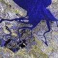
Floods – The increasing number of intense meteorological events means that flood events are more frequent. Their monitoring is essential to rescue and civil defence authorities, whilst mapping of their extent is widely by insurance companies.
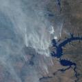
Forest Fires – The identification of fire hot spots and the spread of fire events from satellite is used not only in the natural environment but also for fires linked to industrial disasters.
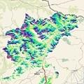
Landslides – The mapping of the extent of damage caused by large landslides is crucial to the recovery services. A large amount of work is however aimed particularly at the study of prediction and prevention of such events.

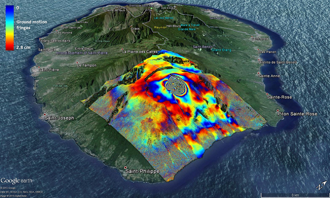
Earthquakes & Volcanic Eruptions – The tragic consequences of both earthquake and volcanic activity are obvious, their monitoring and timely mapping is essential to aid rescue efforts. While improved prediction is aimed at reducing the impact of any such an event.

Humanitarian Crises – In recent years Earth Observation satellites have become a new asset at the disposal of emergency response teams. Satellites can perform rapid damage-mapping to help guide rescue efforts.

Oil Spills – The possibility of using satellite data over ocean areas to monitor the spread of oil spills is essential in directing the interventions of the environmental authorities, thereby ensuring timely cleansing and reducing their impact.
Source: https://sentinels.copernicus.eu/web/sentinel/thematic-areas/emergency-management

 https://sentinels.copernicus.eu/
  https://sentinels.copernicus.eu/
 https://sentinels.copernicus.eu/


Leave a Reply
Want to join the discussion?Feel free to contribute!