 https://sentinels.copernicus.eu/
Sentinel-2 Data Products
Sentinel-2 products available for users (either generated by the ground segment or by the Sentinel-2 Toolbox) are listed in the product types table.
| Name | High-Level Description | Production & Distribution | Data Volume |
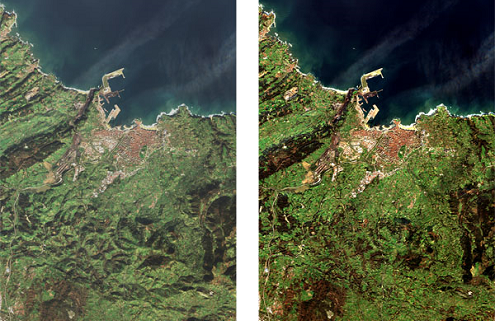
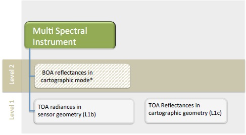
| Level-1C | Top-Of-Atmosphere reflectances in cartographic geometry | Systematic generation and online distribution | ⁓600MB (each 100km x 100km2) |
| Level-2A | Bottom-Of-Atmosphere reflectances in cartographic geometry | Systematic and on-user side (using Sentinel-2 Toolbox) | ⁓800MB (each 100km x 100km2) |
Products are a compilation of elementary granules of fixed size, along with a single orbit. A granule is the minimum indivisible partition of a product (containing all possible spectral bands).
For Level-1C and Level-2A, the granules, also called tiles, are 100×100 km2 ortho-images in UTM/WGS84 projection. Download the Sentinel-2 tiling grid kml.
The UTM (Universal Transverse Mercator) system divides the Earth’s surface into 60 zones. Each UTM zone has a vertical width of 6° of longitude and horizontal width of 8° of latitude.
Source: https://sentinels.copernicus.eu/web/sentinel/missions/sentinel-2/data-products